What to Expect on the Talamroute Summit Day Hike
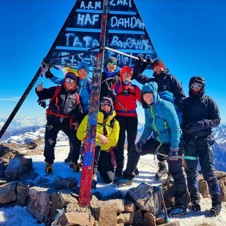
The Talamroute summit day hike is a guided High Atlas summit loop from Marrakech to the 2,650 m Talamroute summit via the Tizi n’Tamatert pass. Expect forest trails, Berber village paths, a sustained climb of about 1,070 m and panoramic Toubkal views from the top. The published route figures (15 km loop, ~6 hours, ~1,070 m ascent) are draft references pending local-guide confirmation.
The Talamroute summit day hike is a genuine High Atlas summit challenge packed into a single day from Marrakech. It is built for active walkers who want a real mountain summit without committing to a multi-day trek. This guide explains what the day involves — the route, the effort, the scenery and the summit — so you can decide whether it is right for you. All route metrics here are draft figures pending local-guide confirmation; the final route, grade and conditions are verified before each departure.
The route at a glance
The Talamroute hike begins with a private transfer from Marrakech to the Imlil trailhead. From there you climb steadily through forest and Berber village paths, crossing the classic Tizi n’Tamatert pass before pushing to the 2,650 m Talamroute summit. You descend by a different loop path back to the trailhead and transfer back to Marrakech by evening.
The published figures — a 15 km loop, about 6 hours of walking and about 1,070 m of ascent — are provisional references only. A local guide confirms the exact route, grade and current conditions before each departure, because mountain trails change with the seasons and the weather.
Talamroute summit day hike — full details and departure calendar
The climb and the effort
Talamroute is graded Moderate (draft). The ascent is sustained — roughly 1,070 m of climbing over the day — but there is no technical climbing on the standard summer route. The pace is set by your guide to suit the group, with rest stops at natural viewpoints. You should be comfortable walking for about six hours on uneven mountain ground with a sustained climb.
The reward for the climb is a panoramic summit view across the Toubkal massif. On a clear day you can see the high peaks stretching in every direction, with the Imlil valley far below. The descent follows a different path, so the scenery changes throughout the day.
The scenery: forest, villages and summit
What makes Talamroute distinctive is the variety of the landscape. The lower section winds through forest and walnut groves, then opens onto Berber village paths with terraced fields and stone houses. As you climb above the tree line the terrain becomes more open and rocky, culminating in the summit ridge with its sweeping views.
The cultural depth of the village paths is part of what makes this hike feel like a real mountain journey rather than a viewpoint stop. Your guide can point out traditional farming, irrigation channels and village life along the way.
Winter considerations
Talamroute reaches 2,650 m, which means winter conditions above 2,500 m are a real consideration. From December through February, snow and ice are possible on the upper section after storms. Winter departures are explicitly subject to guide and weather checks before any date is confirmed.
Your guide assesses conditions and will advise the safest option. Safety always takes priority over reaching the summit — a turned-back summit is better than a risky one.
What is included
The Talamroute hike includes a local Berber guide, a packed lunch, bottled water and a private round-trip transfer from Marrakech. Transfers are priced separately from the trek (€90 total for 1–3 people, or €35 per person for 4 or more). No other inclusions are invented; the full list is confirmed in your written proposal.
Frequently asked questions
How hard is the Talamroute hike?
It is graded Moderate (draft). Expect a sustained ascent of about 1,070 m over roughly 15 km, with about 6 hours of walking on uneven mountain ground. No technical climbing is needed on the standard summer route. The final grade is confirmed by a local guide before each departure.
What are the route figures based on?
The published figures — a 15 km loop, about 6 hours walking and about 1,070 m ascent via Tizi n’Tamatert — are draft references pending local-guide confirmation. The operator confirms the exact route, grade and current conditions before each departure.
What will I see on the Talamroute hike?
Forest and walnut groves on the lower section, Berber village paths with terraced fields, open rocky terrain as you climb above the tree line, and a panoramic summit view across the Toubkal massif from the 2,650 m summit.
Is the Talamroute hike suitable in winter?
Winter departures above 2,500 m are subject to guide and weather checks before any date is confirmed. Snow and ice are possible on the upper section after storms. Your guide assesses conditions and advises the safest option.
What is included on the Talamroute hike?
A local Berber guide, a packed lunch, bottled water and a private round-trip transfer from Marrakech. Transfers are priced separately (€90 total for 1–3 people, or €35 per person for 4 or more). The full inclusion list is confirmed in your written proposal.
Related tours
- Talamroute Summit Day Hike from Marrakech — High Atlas Summit via Tizi n’Tamatert
- ISK Summit Day Hike from Marrakech — Forest, Toubkal Views & Waterfall Return
- Imlil Day Hike from Marrakech — Berber Villages & Atlas Valley Walk
Related destinations
Related guides
- What to Expect on the ISK Summit Day Hike
- Talamroute or ISK: Which High Atlas Summit Hike Is Right for You?
- Packing and Seasonal Preparation for a High Atlas Summit Day Hike
- How to Reach the Imlil Trailhead from Marrakech
Related hiking hubs
- Day Hikes from Marrakech: Explore the Atlas Mountains in a Day
- Imlil Hiking & Valley Walks from Marrakech
- Atlas Mountains Hiking in Morocco
Ask a local guide · Request a custom itinerary · Browse all tours